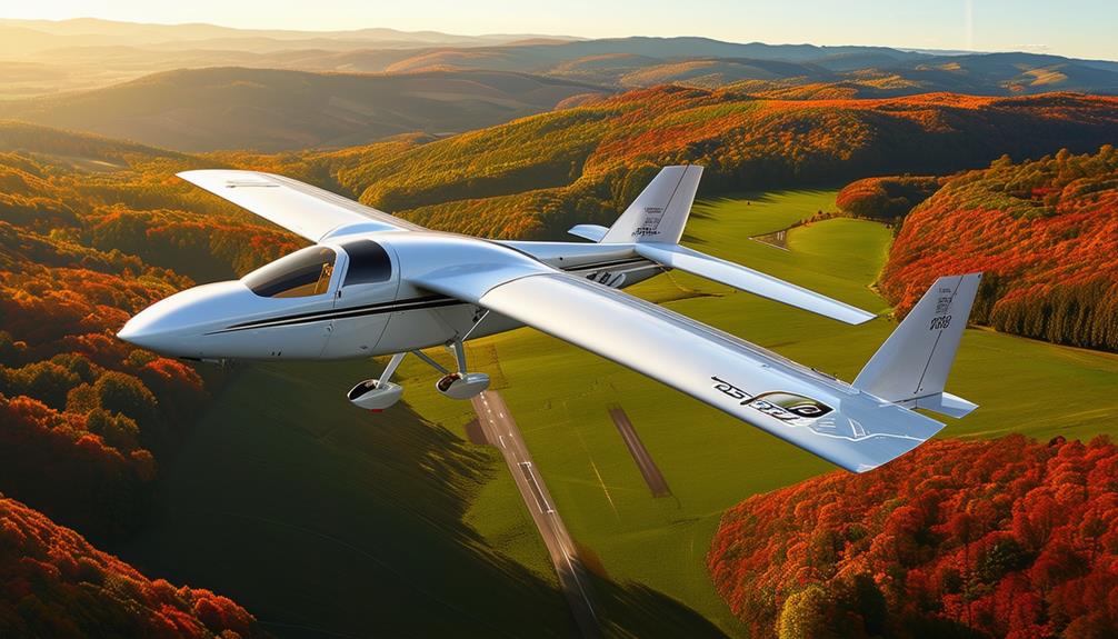
How Glider Pilots Use GPS Technology
When soaring thousands of feet above the ground in a glider, GPS technology becomes indispensable. It provides precise navigation, aids in route planning, and delivers real-time data on location, altitude, and speed.
This isn't just about knowing your position; it's about optimizing your flight path and making informed decisions based on current wind conditions and thermals. Additionally, GPS enhances safety by offering critical information that can help pilots avoid hazardous areas and ensure a smooth landing. Understanding these nuances showcases how GPS technology enriches the gliding experience and guarantees safety.
Benefits of GPS for Gliders
GPS technology provides glider pilots with accurate positional data essential for effective navigation and route planning. In-flight, knowing your exact location is crucial for optimizing your flight path and managing your glide ratio, which indicates how far you can travel horizontally for a given vertical descent.
In competitive gliding, GPS systems are transformative. They offer precise tracking and route optimization, giving you a competitive advantage. Real-time data on wind conditions, thermals, and airspace restrictions enable rapid, informed decision-making. Designed for ease of use, these systems allow you to focus on flying rather than adjusting complex settings.
Additionally, GPS devices facilitate post-flight performance analysis. By logging data throughout your journey, you can review your flight path, altitude changes, and speed adjustments. This analysis is invaluable for honing your skills and strategies for future flights.
Whether for leisure or competition, the benefits of GPS technology in gliders are evident. It enhances the smoothness, safety, and efficiency of your flight, enabling you to enjoy the skies to the fullest.
Real-Time Navigation Data
Real-time flight data provides glider pilots with the crucial information needed for efficient and safe navigation. Utilizing GPS technology, pilots receive essential details such as current location, altitude, ground speed, and distance to the next waypoint. This information isn't just useful; it's vital for making strategic in-flight decisions.
Modern GPS devices feature user-friendly interfaces, enabling pilots to quickly interpret flight data. For instance, knowing your glide angle allows you to optimize your flight path for maximum efficiency. Pilots can track their progress in real-time, adjust routes as necessary, and ensure they reach their intended destinations without unnecessary detours.
Additionally, real-time flight data enhances safety by providing accurate positional information, helping pilots avoid airspace violations and potential hazards. This ensures compliance with regulations and allows pilots to focus on enjoying their flights. Whether navigating around obstacles or seeking the most efficient path, GPS technology serves as an indispensable co-pilot in the sky.
Route Planning With GPS
When planning your route using GPS, you can determine the optimal flight paths by analyzing real-time data on wind patterns and thermals. This technology also aids in navigating airspace restrictions and avoiding potential violations. Additionally, GPS enables rapid adjustments based on changing weather conditions, ensuring a smooth and efficient flight.
Identifying Optimal Flight Paths
Glider pilots utilize advanced GPS technology to meticulously plan their routes by analyzing wind conditions, terrain features, and thermal activity. It's essential to consider these factors daily to maximize flight efficiency. Unexpected changes in weather or wind direction can arise, making GPS an indispensable tool for real-time route adjustments.
GPS technology enables the identification of optimal flight paths with precision. Devices provide waypoints, real-time weather updates, and airspace restrictions, offering a comprehensive view of the route. This detailed data supports strategic decisions to optimize flight distance and achieve competitive goals.
Additionally, GPS offers visual representations of flight paths, crucial for navigating complex terrain. Customizable settings on GPS devices can be tailored to match specific flying styles and objectives, enhancing the overall flight experience. Planning your route with GPS not only ensures you follow a path but also optimizes your journey, making the most of thermal lifts and wind currents for a successful and enjoyable flight.
Navigating Airspace Restrictions
Using GPS technology, you can effectively navigate around restricted airspace and ensure compliance with aviation regulations. GPS provides real-time updates on airspace restrictions, enabling you to make informed route adjustments. This capability is vital for avoiding restricted zones and maintaining flight safety and legality.
To plan your route, input waypoints and coordinates into your GPS unit. This creates a flight path that strategically avoids restricted areas, optimizing your navigation and efficiency. By doing so, you enhance your situational awareness, preventing potential conflicts with military operations or other restricted zones.
GPS technology also keeps you updated on dynamic airspace restrictions. As these restrictions can change, staying informed is key to smooth navigation and adherence to regulations. GPS devices provide the necessary data to facilitate seamless adjustments, allowing you to maintain compliance throughout your flight.
Weather Condition Adjustments
With GPS technology, you can adapt your gliding route in real-time based on current weather conditions, ensuring a safer and more efficient flight. Analyzing data on wind direction and speed allows you to make prompt decisions about when to turn, climb, or change course, helping you avoid turbulence and locate thermals for better lift, thereby optimizing your flight path.
GPS technology not only aids in reactive measures but also facilitates proactive route planning. You can chart an optimal course that avoids turbulent areas. Continuous monitoring of your progress and ground speed enables dynamic adjustments to your flight plan, keeping you aware of your surroundings and any weather changes, thus helping you anticipate and mitigate potential issues.
Moreover, GPS assists in navigating through diverse terrains and shifting weather patterns. By leveraging precise, data-driven insights into your environment, you can make informed decisions to enhance your performance. Ultimately, GPS-enabled route planning ensures efficient and safe gliding, improving both your experience and flight success.
Optimizing Flight Efficiency
Utilizing GPS technology allows for precise route planning, ensuring the most efficient flight path. This accuracy aids in better navigation through thermals, minimizing fuel consumption.
Route Planning Precision
Glider pilots frequently rely on GPS technology to optimize wind conditions and thermals, ensuring they choose the most efficient routes. By examining GPS data, pilots can identify lift sources and calculate glide ratios, making strategic decisions to reach their destinations with minimal energy use.
Real-time adjustments help avoid airspace restrictions and maintain steady progress.
Using GPS navigation systems provides accurate information on ground speed, altitude, and heading, enabling informed decisions for efficient route planning. Pilots can pinpoint the best thermals and optimize their flight paths, conserving energy and enhancing overall performance.
The integration of GPS technology in gliding allows pilots to adapt their routes based on current conditions, crucial for cross-country flying. This precision enhances flight efficiency, ensuring every decision is backed by reliable data. Ultimately, GPS technology empowers pilots to optimize their flight paths, making travel smoother and more efficient.
Fuel Consumption Reduction
Building on the precision of route planning, GPS technology plays a crucial role in reducing fuel consumption and optimizing flight efficiency for glider pilots. You can utilize GPS data to chart more direct routes, significantly cutting down on fuel costs. By analyzing wind patterns, you can adjust your flight paths to take advantage of tailwinds and avoid headwinds, minimizing fuel usage.
GPS enables real-time route adjustments based on current wind conditions, ensuring you're always on the most efficient path. Monitoring altitude, speed, and wind conditions via GPS data provides the insights needed to make informed decisions that conserve fuel. By observing how wind speeds and directions change at different altitudes, you can adjust your flight level to find the most favorable conditions.
These steps not only save fuel but also contribute to more sustainable flight practices. Leveraging GPS technology ensures each flight is as efficient as possible, allowing you to focus more on the joy of gliding and less on fuel management.
Safety Features of GPS
Pilots benefit greatly from GPS technology, which provides essential safety features like accurate position tracking and real-time flight data. By using GPS, your exact location is always known, making it easier for emergency services to find you in case of an incident. This is invaluable for search and rescue operations, where every minute counts.
Additionally, GPS systems in gliders are equipped with built-in redundancy features. If the primary GPS signal is lost, the system automatically switches to a backup, ensuring continuous navigation capabilities. This eliminates the worry of unexpected signal loss disrupting your flight.
Here are three top safety benefits of using GPS in gliders:
- Emergency Location Services: Your exact coordinates are transmitted in emergencies, accelerating rescue efforts.
- Real-Time Flight Data: Stay informed about your flight status, altitude, and speed, enabling better decision-making.
- Redundancy Features: Ensure uninterrupted navigation even if the primary GPS signal is lost.
These features enhance situational awareness and provide peace of mind, allowing you to focus on enjoying a safe and efficient flight.
Terrain Avoidance Alerts
Terrain avoidance alerts in GPS technology significantly enhance your ability to avoid collisions with challenging landscapes by offering real-time warnings. These alerts utilize GPS data to determine your glider's position relative to the surrounding terrain. Upon detecting a potential conflict, the system promptly issues warnings, providing you with valuable time to react and adjust your course.
These alerts are particularly crucial when flying in mountainous or rugged areas. The system continuously monitors your proximity to the ground and other obstacles, enhancing safety by keeping you informed of any changes in the landscape.
Additionally, the alerts are highly customizable. You can adjust the settings to match your preferences and the specific requirements of your flight. Whether you're gliding over rolling hills or navigating through steep mountain ranges, these alerts offer flexibility in managing terrain risks.
Accurate Landing Guidance
With GPS technology, you obtain precise landing guidance, ensuring a safe and efficient descent to the designated landing zone. By leveraging GPS data, you can monitor your position in real-time and make necessary adjustments for a smooth landing. Visual displays provided by GPS systems enable you to evaluate wind conditions, obstacles, and other factors that might influence your approach.
Relying on GPS information enhances situational awareness during the critical landing phase, reducing the risk of misjudging approach angles or landing spots. The precision of GPS technology improves safety and efficiency by offering exact positioning and guidance for your landing maneuvers.
Here's how GPS technology can instill a sense of confidence and security during your landing:
- Real-time Position Tracking: Know exactly where you're at all times, facilitating last-minute adjustments.
- Visual Landing Area Displays: Access clear visuals of the landing zone, including wind conditions and potential obstacles.
- Enhanced Situational Awareness: Stay fully informed of your surroundings, minimizing the risk of landing errors.
GPS in Various Weather Conditions
How does GPS technology empower glider pilots to navigate accurately even in unpredictable weather conditions? By leveraging real-time data, GPS units provide critical information on wind direction and speed, enabling pilots to adjust their flight paths for optimal performance, even in low visibility or turbulent air.
In challenging weather, such as encountering thermals or strong headwinds, GPS assists pilots in making informed decisions to enhance efficiency and safety. Pilots can monitor their position, altitude, and distance to waypoints, ensuring precise navigation despite adverse conditions.
Additionally, GPS devices often provide access to weather data, enabling pilots to anticipate changes in weather. This helps in adjusting flight strategies, leading to smoother and more successful flights.
Here's a table summarizing how GPS aids in different weather conditions:
| Weather Condition | GPS Benefit |
|---|---|
| Low visibility | Accurate navigation and position tracking |
| Turbulent air | Real-time wind data for path adjustments |
| Thermals | Informed decisions for efficient flight |
| Strong headwinds | Optimization of performance and safety |
| Changing weather | Anticipation and strategy adjustment |
Popular GPS Systems for Gliders
Glider pilots often rely on GPS systems like Flymaster, Oudie, Kobo, and XCTracks to enhance their navigation and flight performance. These systems are essential tools, offering critical navigation data that's vital for competitions, cross-country flights, and general flying activities. In the air, making informed decisions and tracking progress is crucial for a successful flight.
Each GPS system offers unique features to cater to various needs:
- Flymaster: Known for its advanced flight computers and intuitive interface, Flymaster is suitable for both experienced pilots and novices.
- Oudie: Oudie devices are praised for their high-resolution displays and robust software, enabling clear visualization of flight paths.
- XCTracks: A favorite among glider pilots, XCTracks provides customizable features and an open-source platform, offering flexibility and adaptability to individual flying preferences.
These systems ensure semantic accuracy, completeness, consistency, conciseness, relevance, interoperability, and trustworthiness in flight navigation and performance optimization.
Enhancing Flight Experience
Leveraging GPS technology can greatly enhance your flight experience by providing real-time navigation information. As a glider pilot, you can monitor your position, speed, altitude, and distance to waypoints, making it easier to stay on course and efficiently reach your destination. This optimization of routes aids in better planning for cross-country flights and strategic decision-making during competitions.
Real-time data on wind conditions, thermals, and airspace restrictions further enhances safety and efficiency. GPS technology offers crucial information to help you avoid hazardous areas and capitalize on favorable wind currents. This not only improves safety but also optimizes flight performance.
Additionally, GPS technology enables the logging of flight data for post-flight analysis. Reviewing this data allows you to identify areas for improvement and refine your skills for future flights. Whether you're a seasoned competitor or a recreational pilot, the ability to analyze flight data fosters continual growth and improvement.
Conclusion
Leveraging GPS technology enhances glider flights with precise navigation, efficient route planning, and heightened safety. Real-time data enables informed decision-making, optimizing glide ratios and effectively managing varying weather conditions. Renowned GPS systems provide dependable performance, allowing you to focus on the joy of soaring. Embrace GPS technology to fly smarter, safer, and more efficiently every time you take to the skies.